
Proposed Policy Map Changes
Main Modifications Consultation 2026
View the Main Modifications Consultation 2026
Inset Map Inset 5 – Braunston-in-Rutland
Map Element
PLD
Proposed Modification
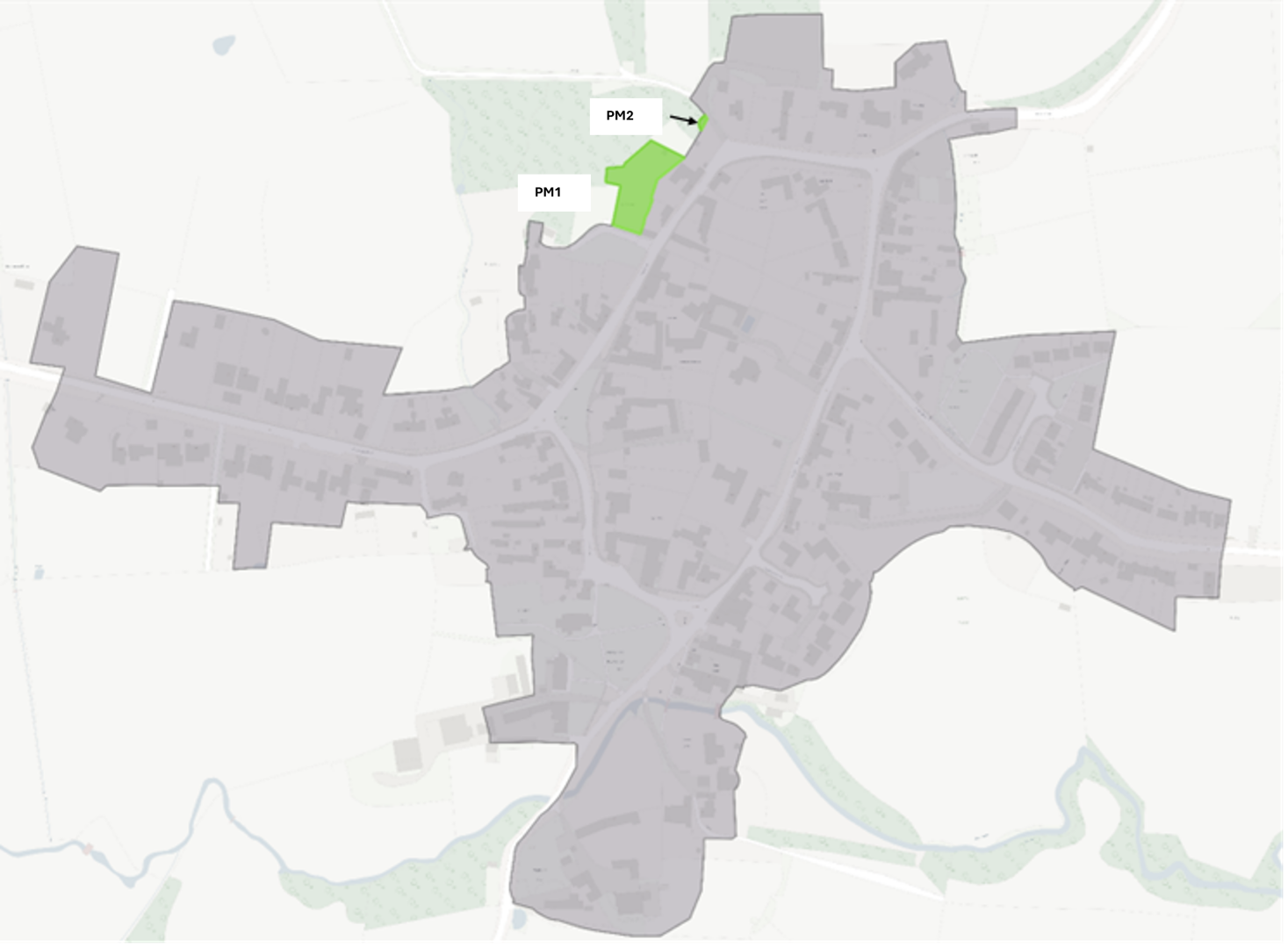
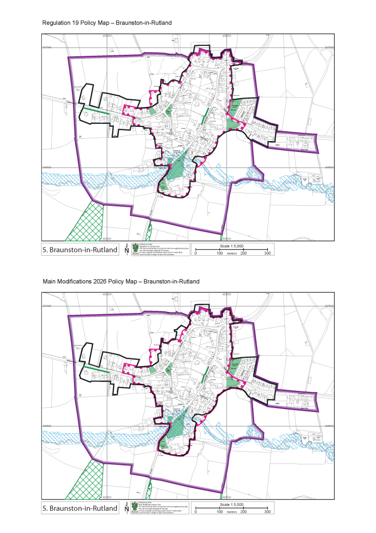
Amend PLD to account for change of use to residential dwelling and increase of residential curtilage. - 2023/1325/FUL
PLD Change – (Green addition to PLD/ Red removal from PLD)
Reason
To reflect recent planning permissions in line with principles B and C of the Delivered Rutland PLD Review Report – October 2023 (EV5.3)
PM2 View representations
Inset Map Inset 5 – Braunston-in-Rutland
Map Element
PLD
Proposed Modification
Amend PLD to account for change of use to residential dwelling and increase of residential curtilage. - 2023/1325/FUL
PLD Change – (Green addition to PLD/ Red removal from PLD)
Reason
To reflect recent planning permissions in line with principles B and C of the Delivered Rutland PLD Review Report – October 2023 (EV5.3)
PM3
Inset Map Inset 8 - Edith Weston
Map Element
PLD
Proposed Modification
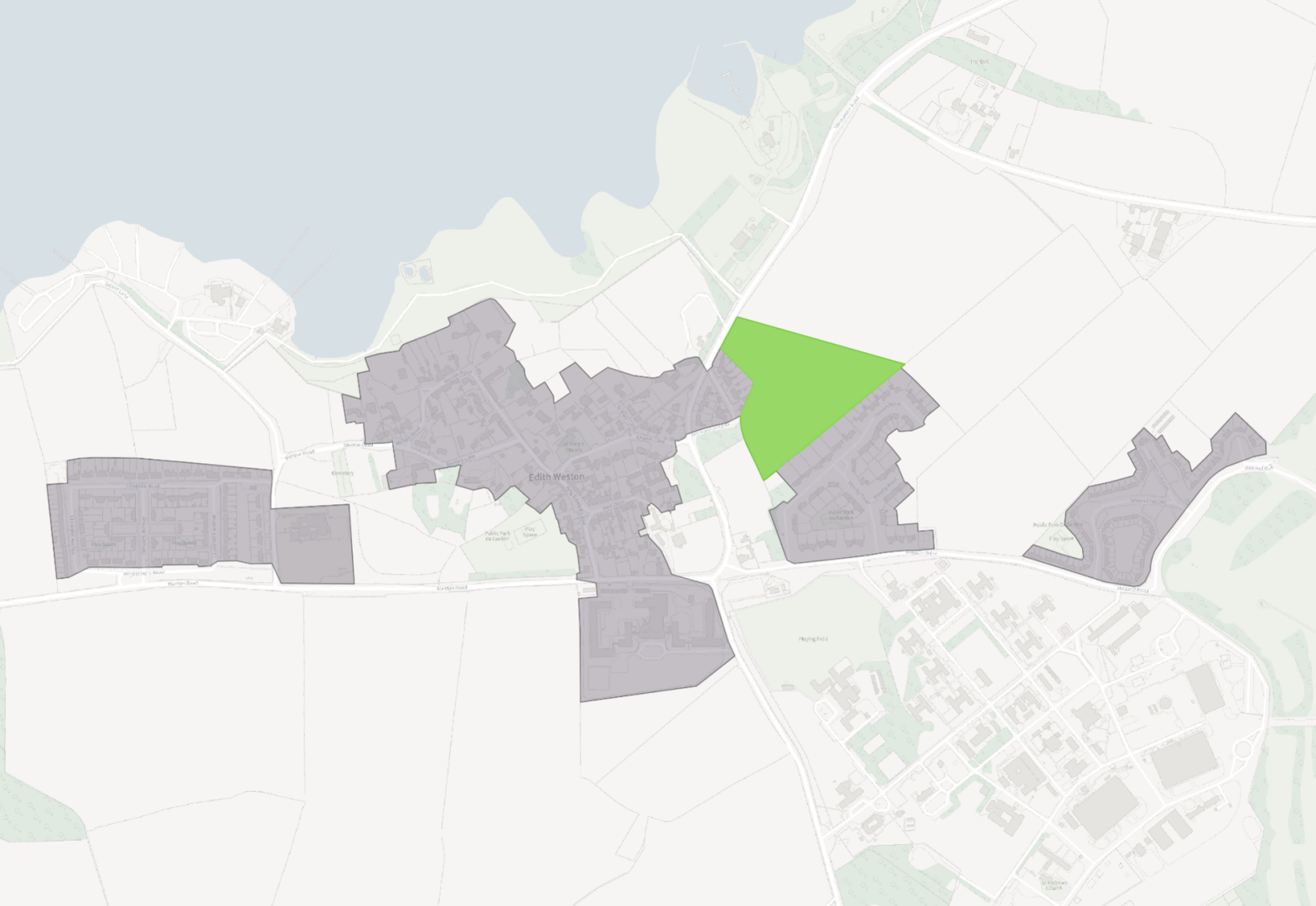
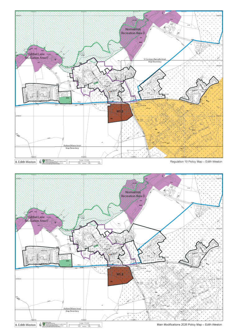
Amend the PLD to account for planning permission 2025/0492/MAO
PLD Change – (Green addition to PLD/ Red removal from PLD)
Reason
To reflect recent planning permissions in line with principles B and C of the Delivered Rutland PLD Review Report – October 2023 (EV5.3)
PM4 View representations
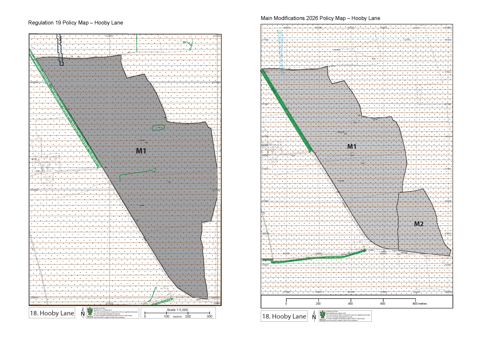
Inset Map Inset 18 - Hooby Lane
Map Element
Minerals Allocations
Proposed Modification
Add M2 Hooby Lane North Minerals allocation.
Reason
Existing allocation M1 contains limited building stone. The Council therefore proposed that an additional site should be allocated at Hooby Lane North to ensure a continuing local supply of building stone
PM5
Inset Map Inset 19 - Ketton
Map Element
Employment Allocation E1.4 now E1.2
Proposed Modification
Renumbered Employment Allocation from E1.4 to E1.2
.png)
Reason
Other Employment Allocations have been removed, and a new one has been added resulting in numbering changes.
PM6
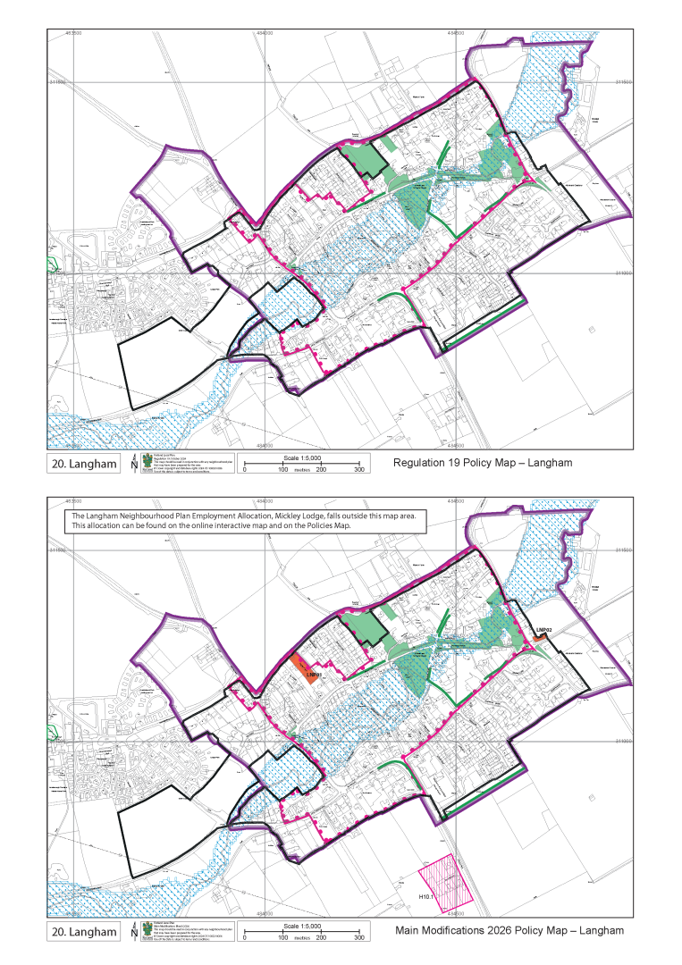
Inset Map Inset 20 - Langham
Map Element
GT&T Allocation
Proposed Modification
Add H10.1 Langham Gypsy Traveller and Travelling Showpeoples site.
Reason
Allocation was not featured on previous mapping.
PM7
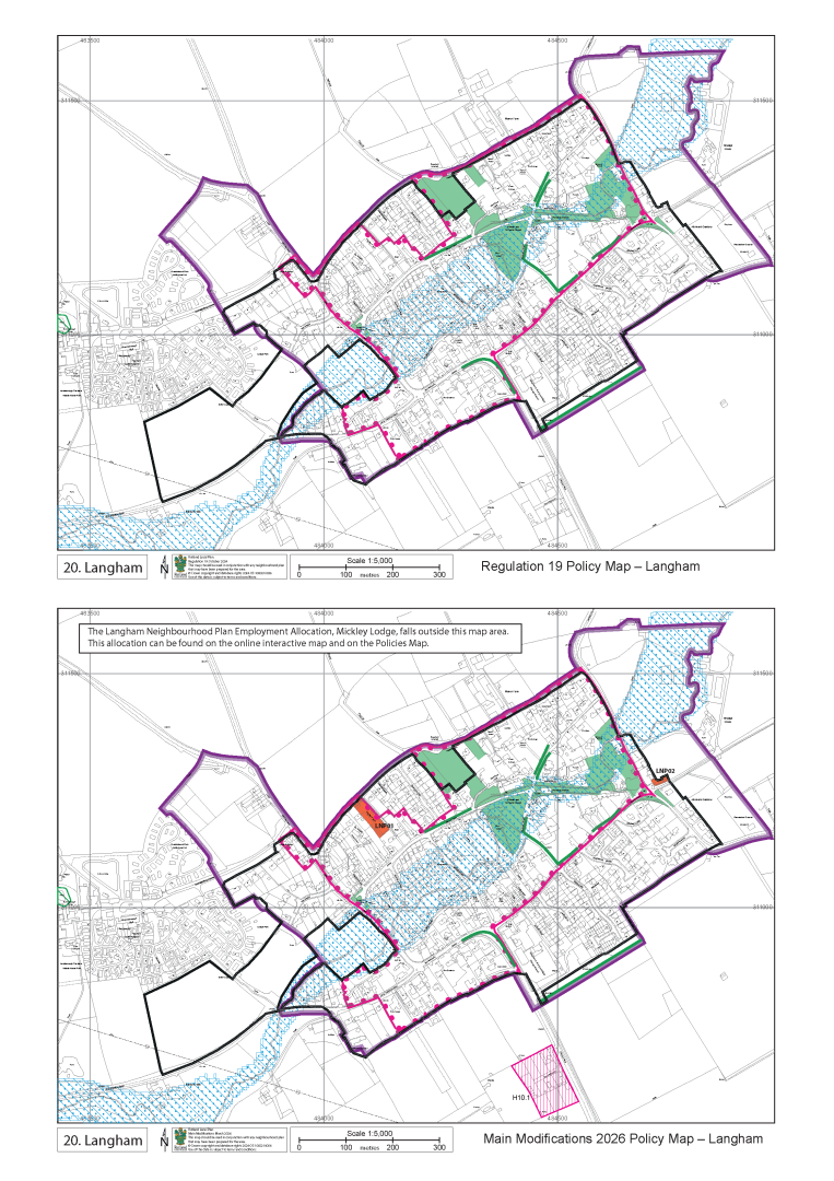
Inset Map Inset 20 - Langham
Map Element
Neighbourhood Plan Allocations
Proposed Modification
Add Langham Neighbourhood Plan housing allocations (LNP01 and LNP02)
Reason
For clarity and consistency all Neighbourhood Plan allocations are included on Local Plan maps.
PM8
Inset Map Inset 20 - Langham
Map Element
New text box for information
Proposed Modification
Add text box to the map to read:
“The Langham Neighbourhood Plan Employment Allocation, Mickley Lodge, falls outside this map area. This allocation can be found on the online interactive map and on the Policies Map.”
Reason
Langham Neighbourhood Plan allocates an employment allocation (LNP03) that cannot be presented on the Inset.
PM9 View representations
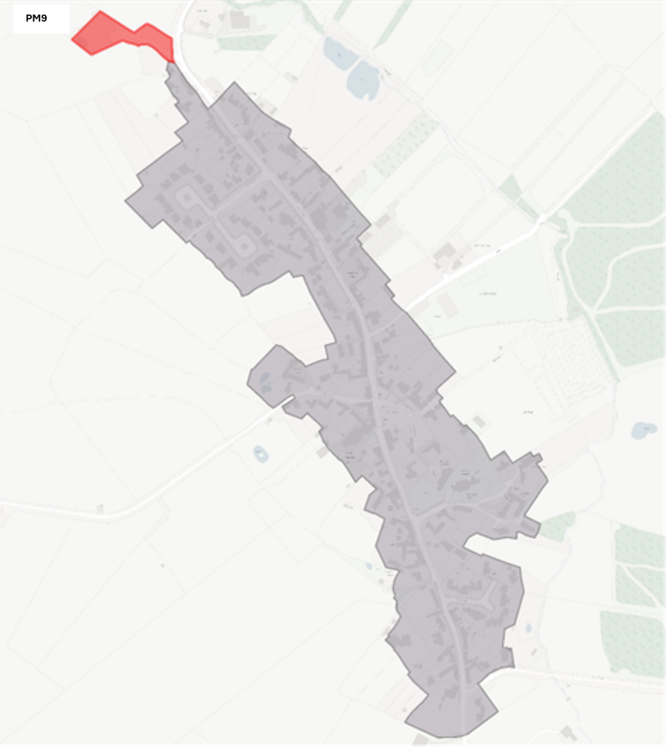
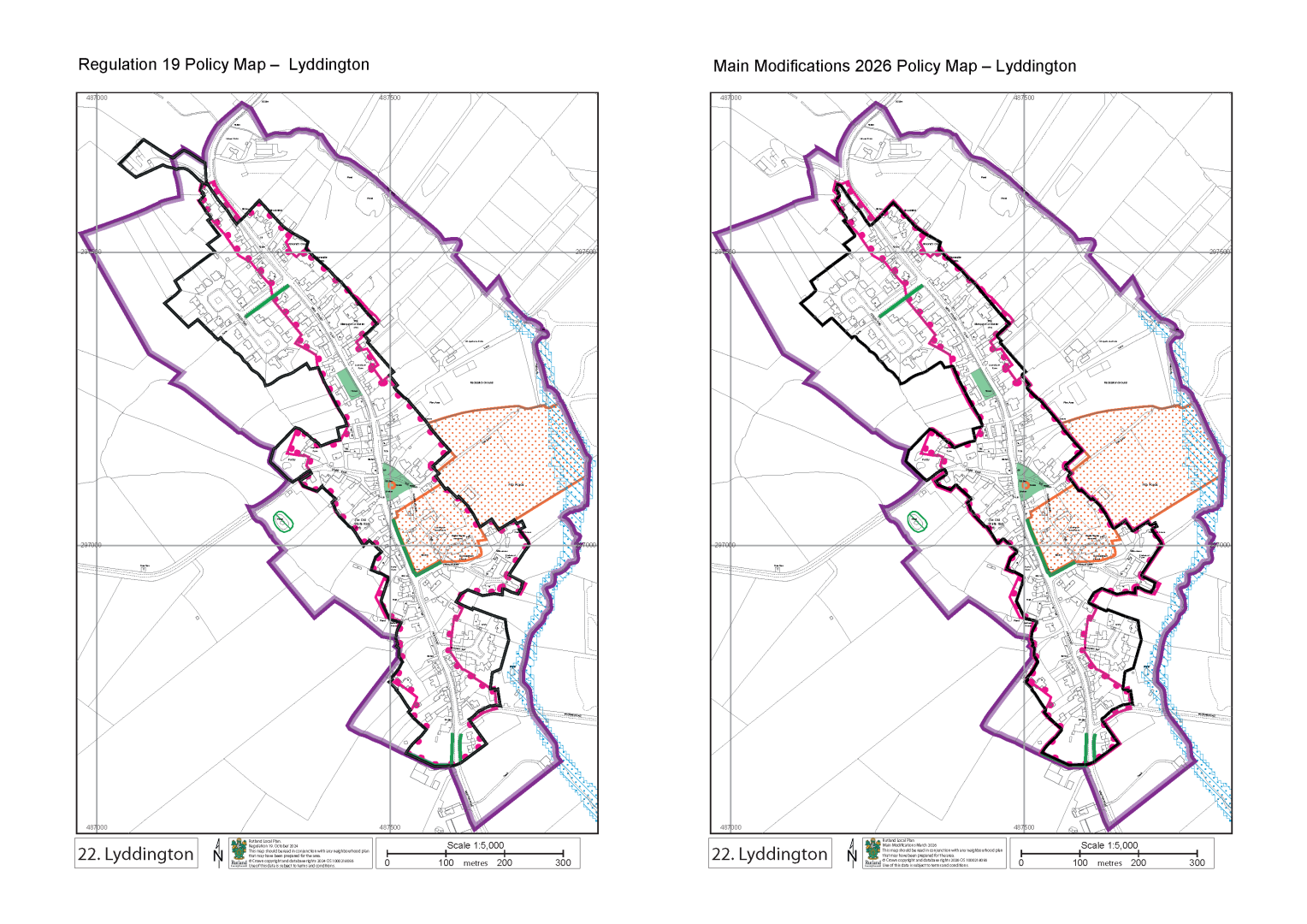
Inset Map Inset 22 - Lyddington
Map Element
PLD
Proposed Modification
Correct drafting error at northern end of the village to return PLD to that included in Regulation 18 Draft Local plan.
PLD Change – (Green addition to PLD/ Red removal from PLD)
Reason
Correction
PM10 View representations
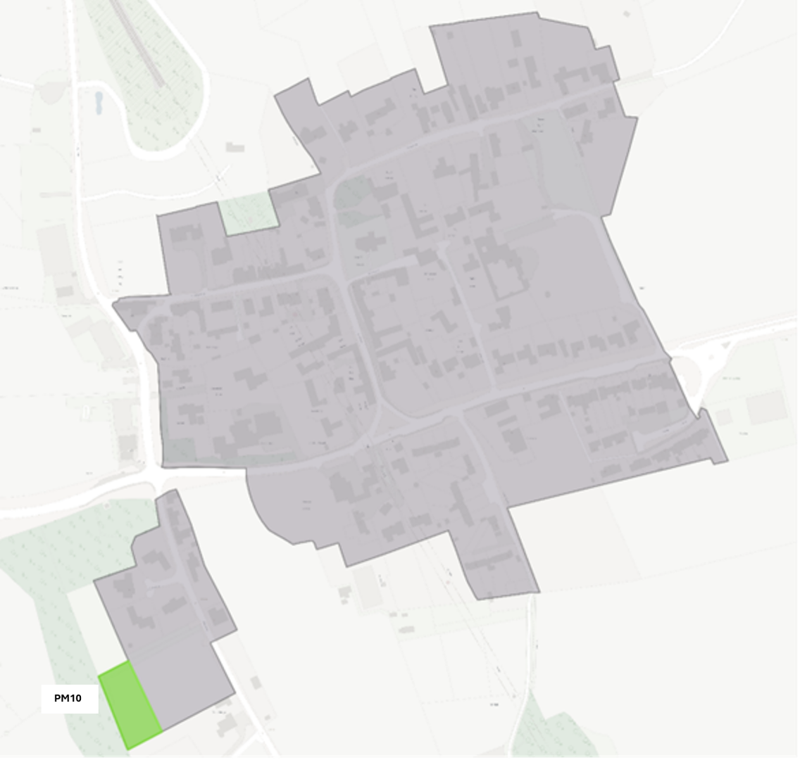
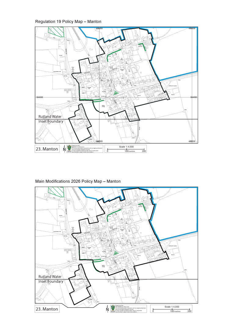
Inset Map Inset 23 - Manton
Map Element
PLD
Proposed Modification
Amend PLD to account for planning permission 2024/0698/FUL
PLD Change – (Green addition to PLD/ Red removal from PLD)
Reason
To reflect recent planning permissions in line with principles B and C of the Delivered Rutland PLD Review Report – October 2023 (EV5.3)
PM11
Inset Map Inset 27 - Oakham & Barleythorpe
Map Element
Employment Allocation E1.3
Proposed Modification
Remove employment allocation site (E1.3 – Burley’s Appliances)
_2.png)
Reason
Allocation removed as agreed at the Examination hearing sessions – site has planning permission for 61 residential units.
PM12
Inset Map Inset 27 - Oakham & Barleythorpe
Map Element
New Employment Allocation E1.5
Proposed Modification
Add Hackamore Way employment allocation site to reflect planning application reference 2023/1199/FUL
_1.png)
Reason
Allocation added as agreed at the Examination hearing sessions.
PM13
Inset Map Inset 34 - South Luffenham
Map Element
Employment Allocation E1.6 now E1.4
Proposed Modification
Renumber existing Employment
_1.png)
Reason
Other Employment Allocations have been removed, and a new one has been added resulting in numbering changes.
PM14
Inset Map Inset 35 - St Georges Barracks
Map Element
Future Opportunity Areas and whole Inset.
Proposed Modification
Remove St George’s Barracks site and remove Inset map, also remove inset box on Policies Map, Rutland Water Map and Edith Weston Inset Map.
Reason
Policy SS4 removed by Inspector during Examination hearing sessions
PM15
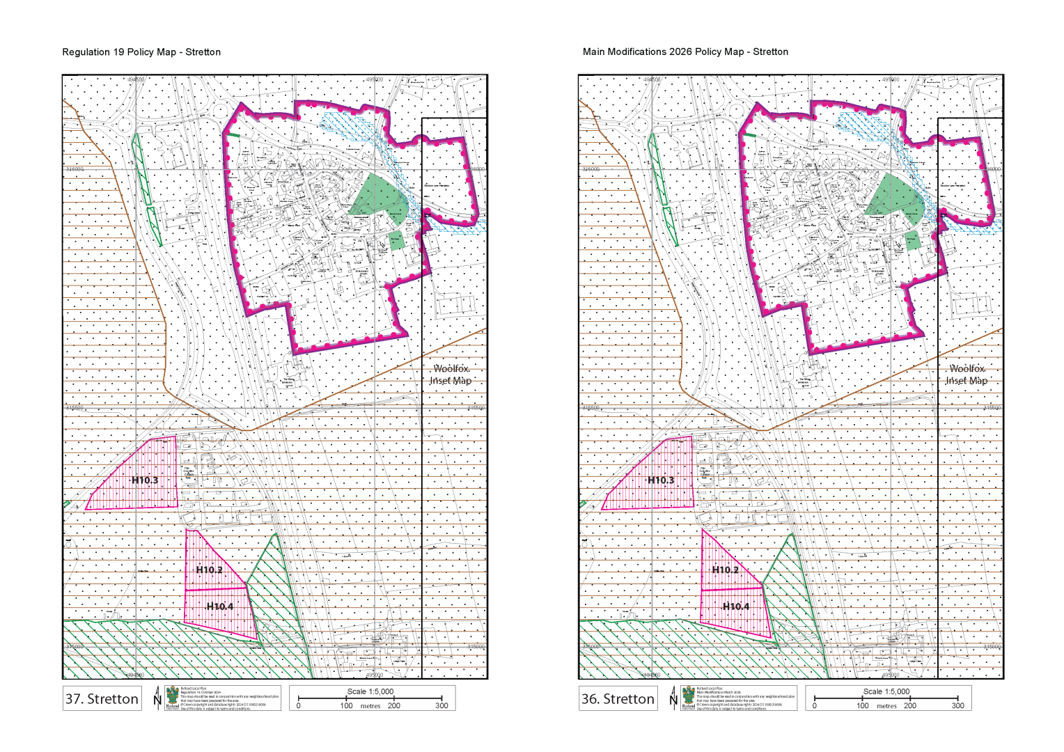
Inset 36 – Stretton
Map Element
Gypsy, Traveller and Travelling Showpeoples Allocation, H10.2
Proposed Modification
Amend the boundary.
Reason
For clarity and consistency all Neighbourhood Plan allocations are included on Local Plan maps. All sites in Uppingham have been allocated through the Uppingham Neighbourhood Plan.
PM16
Inset Map Inset 40 - Uppingham
Map Element
Neighbourhood Plan Allocations
Proposed Modification
Add Uppingham Neighbourhood Plan Allocations. (UHA1, UHA2, UHA3 and Reserve Allocations UHA4 and UHA5)
_1.jpg)
Reason
For clarity and consistency all Neighbourhood Plan allocations are included on Local Plan maps. All sites in Uppingham have been allocated through the Uppingham Neighbourhood Plan.
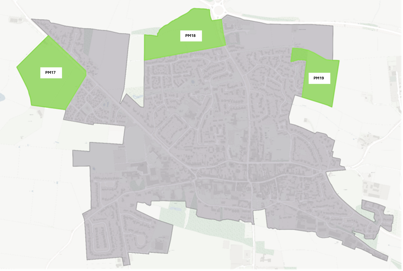
PM17
Inset Map Inset 40 - Uppingham
Map Element
Employment Allocation E1.2
Proposed Modification
Remove employment allocation site (E1.2 – Uppingham Gate)
PLD Change – (Green addition to PLD/ Red removal from PLD)
.jpg)
Reason
Allocation removed as agreed Examination hearing sessions – existing policy in made Uppingham Neighbourhood Plan (Policy U-HA3)
PM18
Inset Map Inset 40 - Uppingham
Map Element
PLD
Proposed Modification
Ensure the PLD for Uppingham is up to date in accordance with the latest made Uppingham NP (following receipt of Examiners Report and referendum) This PLD amendment is a result of allocation U-HA1.
PLD Change – (Green addition to PLD/ Red removal from PLD)
Reason
Consistency with the latest “made” Uppingham NP
PM19
Inset Map Inset 40 - Uppingham
Map Element
PLD
Proposed Modification
Ensure the PLD for Uppingham is up to date in accordance with the latest made Uppingham NP (following receipt of Examiners Report and referendum) This PLD amendment is a result of allocation U-HA2 and reserve allocation U-HA5.
PLD Change – (Green addition to PLD/ Red removal from PLD)
Reason
Consistency with the latest “made” Uppingham NP
PM20
Inset Map Inset 40 - Uppingham
Map Element
PLD
Proposed Modification
Ensure the PLD for Uppingham is up to date in accordance with the latest made Uppingham NP (following receipt of Examiners Report and
referendum) This PLD amendment is a result of reserve allocation U-HA4.
Reason
Consistency with the latest “made” Uppingham NP
PM21
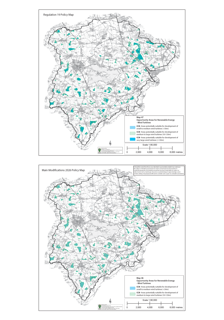
Inset Map Inset 46 – Wind Map
Map Element
CC8 - Areas potentially suitable for development of very large wind turbines (>120m)
Proposed Modification
Remove “Areas potentially suitable for development of very large wind turbines (>120m)” from map.
Reason
For clarity and consistency with Policy CC8 rewording. There are no locations in Rutland that are appropriate for this kind of development.
PM22 View representations
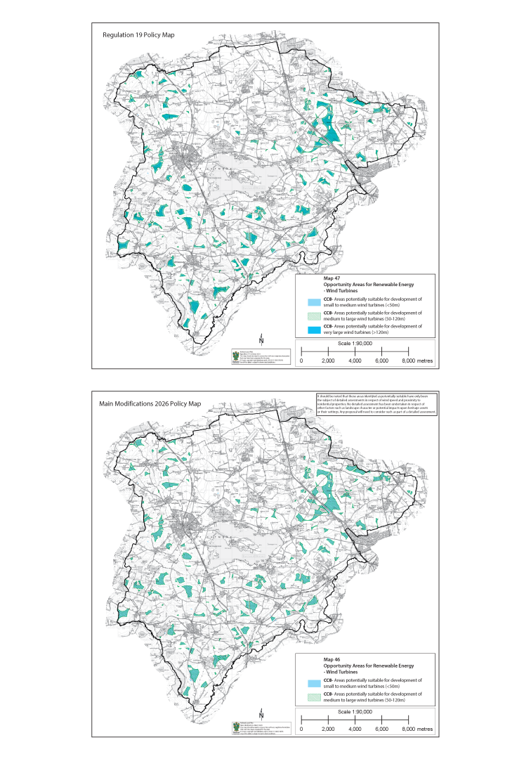
Inset Map Inset 46 – Wind Map
Map Element
New text box for information
Proposed Modification
Add text box to read:
“It should be noted that those areas identified as potentially suitable have only been the subject of detailed assessments in respect of wind speed and proximity to residential properties. No detailed assessment has been undertaken in respect of other factors such as landscape character or potential impacts upon heritage assets or their settings. Any proposal will need to consider such as part of a detailed assessment.”
Reason
For clarity and consistency with Policy CC8 rewording.
PM23
Inset Map Inset 44 - Wing
Map Element
Neighbourhood Plan Allocations
Proposed Modification
Amend map style of Neighbourhood Plan Allocation HBE2
.png)
Reason
For clarity and consistency all Neighbourhood Plan allocations are included on Local Plan maps and have a new style.
PM24
Inset Map Inset 45 - Woolfox
Map Element
Employment Allocation E1.5 now E1.3
Proposed Modification
Renumbered Employment Allocation from E1.5 to E1.3
_1.png)
Reason
Other Employment Allocations have been removed, and a new one has been added resulting in numbering changes.
PM25
Inset Map Inset 45 - Woolfox
Map Element
Employment Allocation E1.3
Proposed Modification
Amend allocation to reflect boundary for planning application 2025/0130/OUT
.png)
Reason
For consistency with planning application.
PM26
Inset Map Inset 45 - Woolfox
Map Element
Future Opportunity Areas
Proposed Modification
Remove Woolfox site and inset box on Policies Map
Reason
Policy SS4 removed by Inspector during Examination hearing sessions
PM27
Inset Map General
Map Element
Insets maps following Inset 35 St Georges Barracks
Proposed Modification
Renumber all inset maps from 35 - St Georges Barracks down a number to account for removed Inset Map.
Reason
Policy SS4 removed by Inspector during Examination hearing sessions therefore Inset map 35 is no longer required.
PM28
Inset Map General
Map Element
Accompanying information text box on all Inset Maps
Proposed Modification
Amend text box to read:
Regulation 19 October 2024
Main Modifications March 2026
Reason
To update the maps to the next stage of the Local Plan process.
PM29
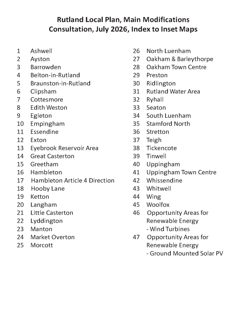
Inset Map Index
Map Element
Index of Inset Maps
Proposed Modification
Remove Inset 35 – St Georges Barracks from Index list
Reason
Policy SS4 removed by Inspector during Examination hearing sessions therefore Inset map 35 is no longer required.
PM30 View representations
Inset Map Legend
Map Element
Mapping Legend
Proposed Modification
Add/Remove keys to account for the changes above.
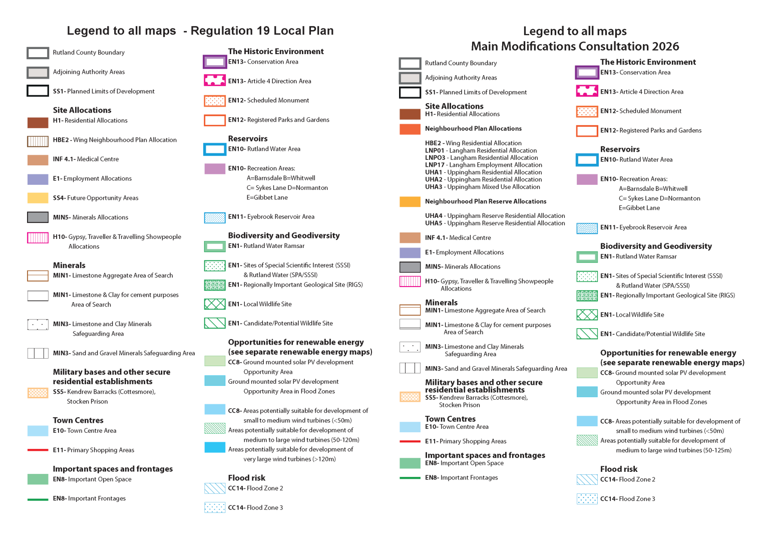
Reason
To account for all changes listed in this schedule.
